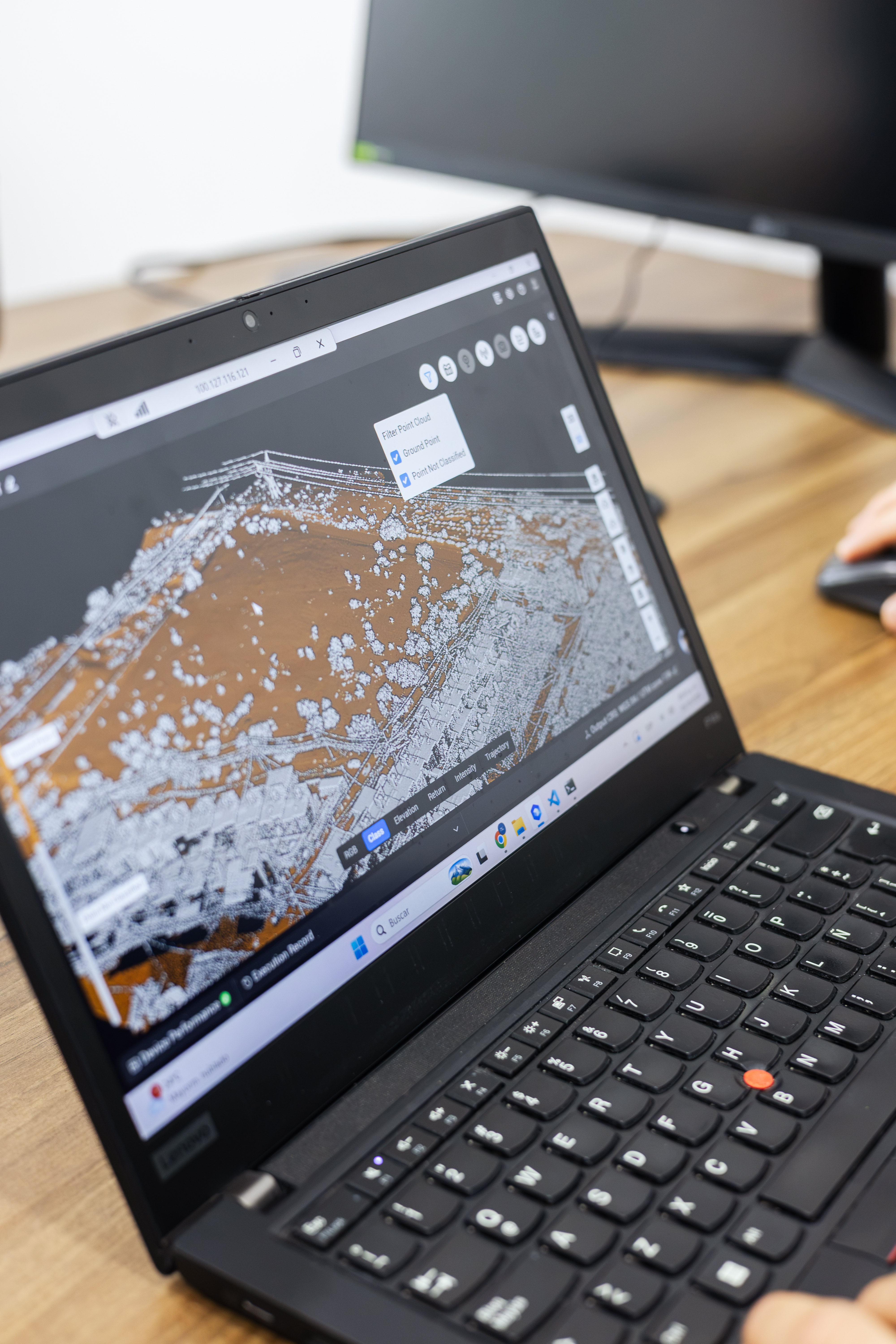
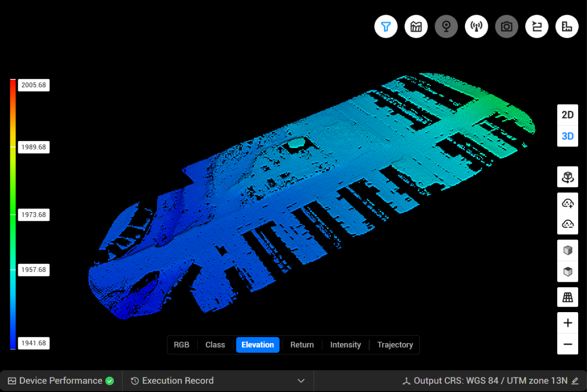
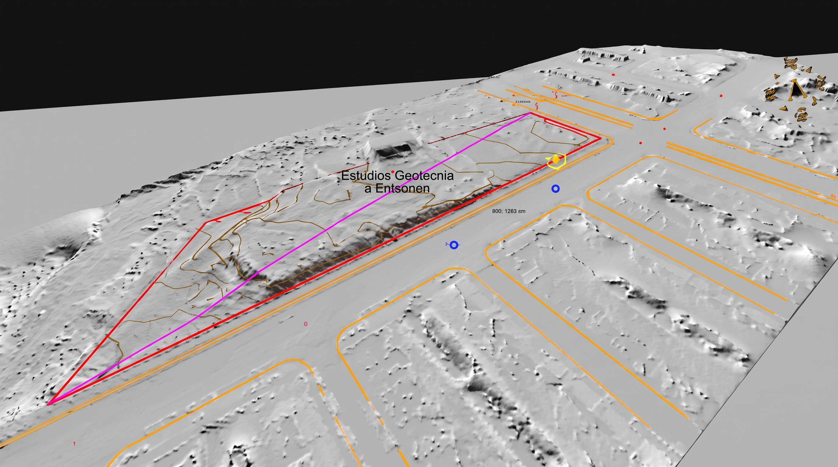
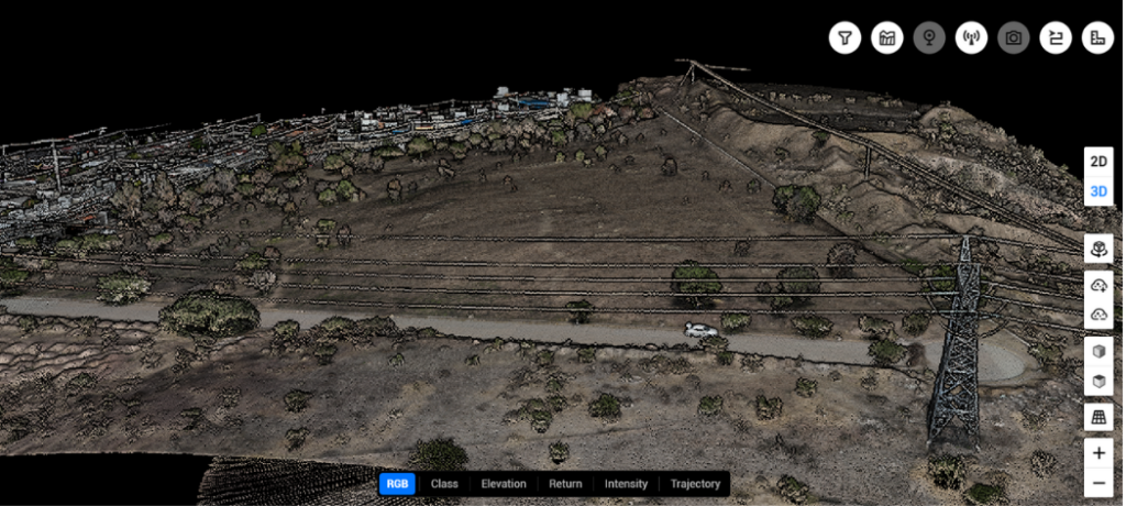
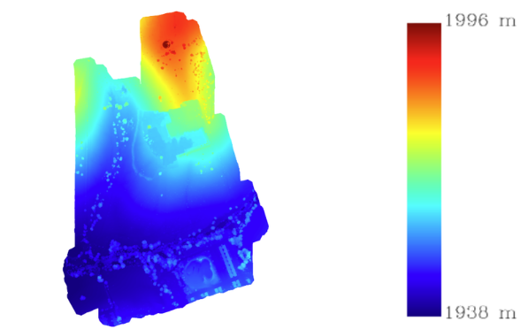
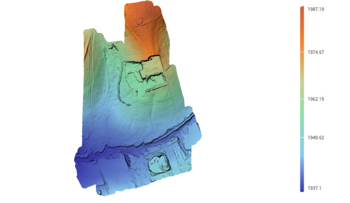
The actual terrain, even where it is hidden by vegetation

LiDAR measures distances using laser pulses emitted from the drone. Each pulse can detect different returns from vegetation, structures, and the ground, making it possible to generate a three-dimensional representation of the site and obtain terrain information even in areas where vegetation makes direct observation difficult.
Subsurface mapping:the actual terrain beneath dense vegetation

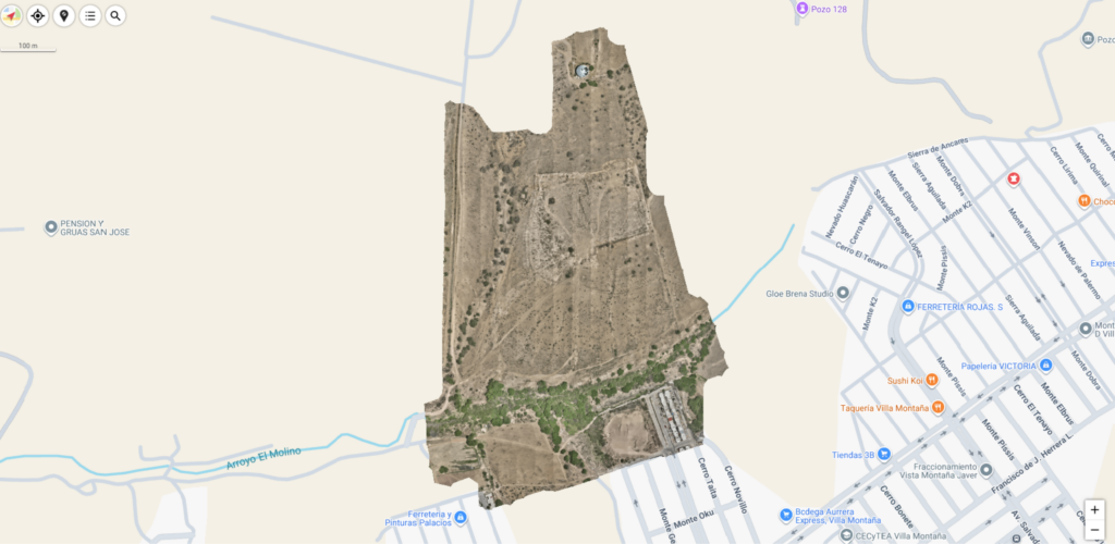
16,000 m²Mapped area
01TheChallenge

A site covered in dense underbrush and accumulated trash needed to be cleaned up, but the vegetation made it impossible to determine the actual topography and calculate the volume of waste to be removed.

02Howdid we do it?

We flew over the site with a LiDAR laser sensor to generate a 3D point cloud. We digitally classified the features and removed the vegetation layer by filtering out the laser’s reflection off the ground.

03Results

We identified outstanding issues, irregularities, and waste. This strategic information enabled us to plan the remediation and obtain quotes for machinery, saving weeks of work compared to traditional methods.

How do we do it?

From Data Collection to Field Information

Planning

Flight plan and waypoints.

Flight

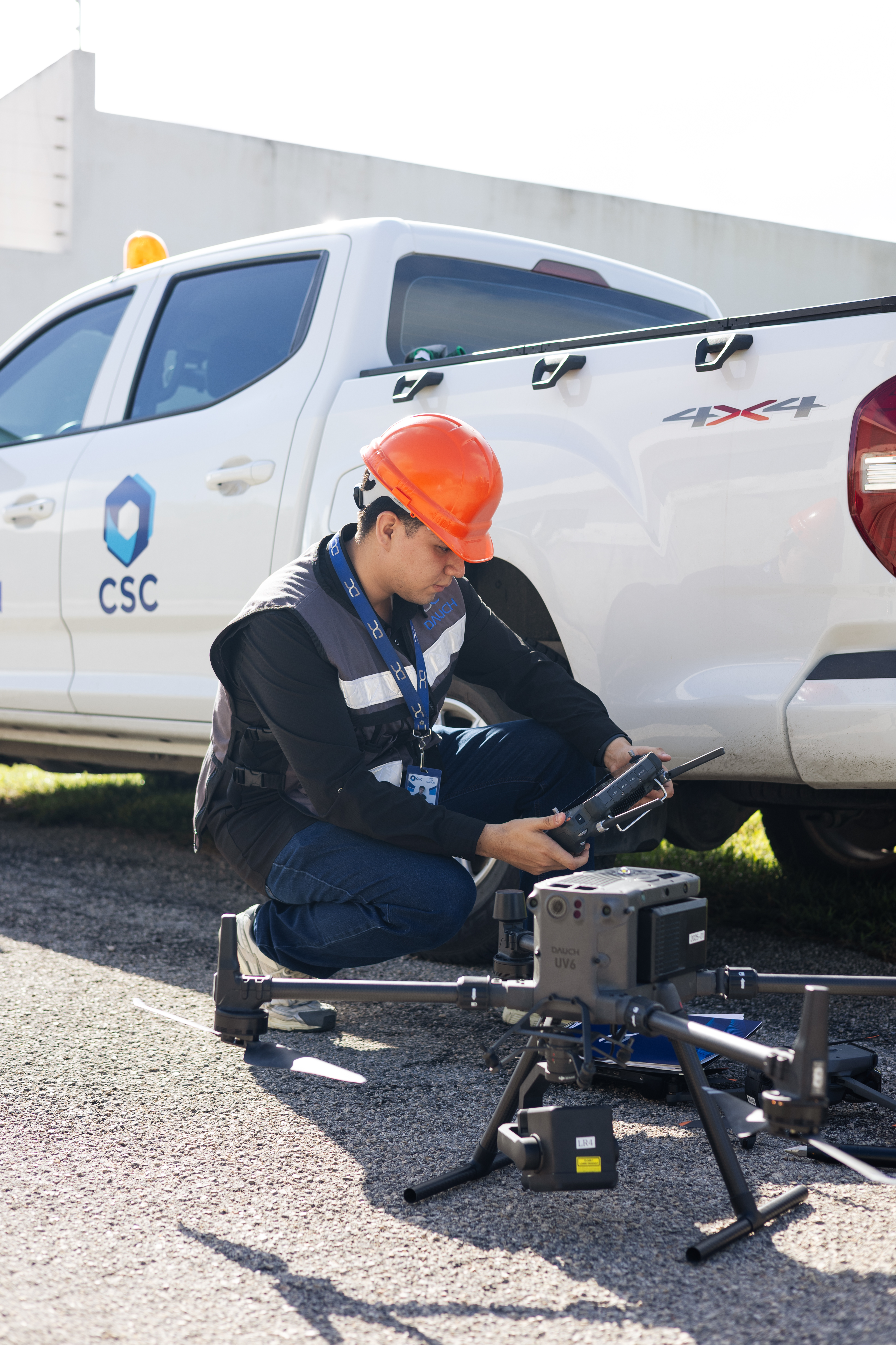
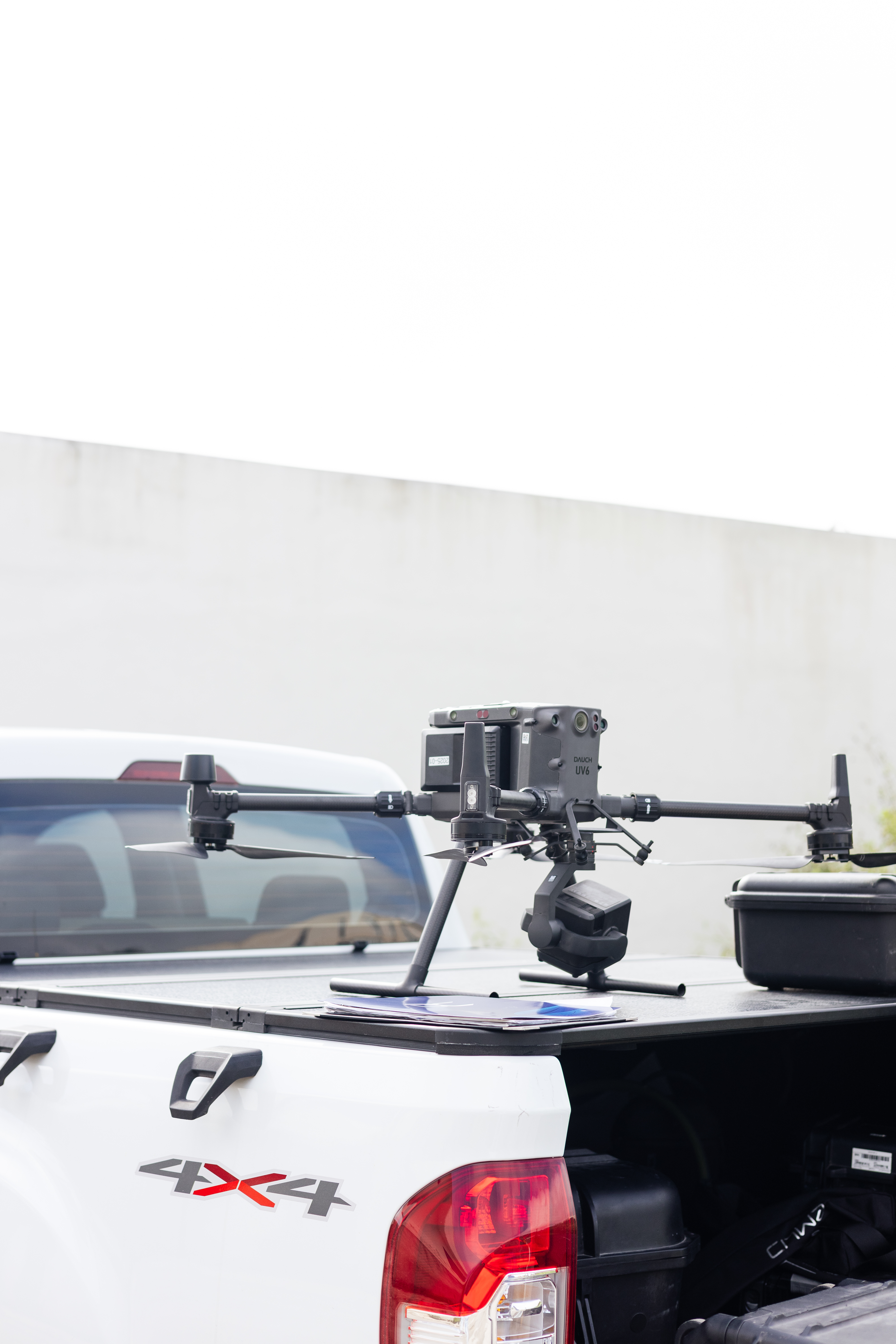
LiDAR sensor with RTK/PPK positioning.

Processing

Trajectory and scatter plot.

Ranking

Soil, vegetation, and buildings.

Products

MDT, contour lines, and volumes.
DAUCH 31 - Dauch DAUCH 19 1 - Dauch DAUCH 76 1 - Dauch LIDAR CLASSIFICATION 1 - Dauch Lidar Products - Dauch
Capabilities

What can we detect?

Land

Analysis of Surfaces Under Dense Vegetation

Volumes

Cut-and-fill calculations for earthwork

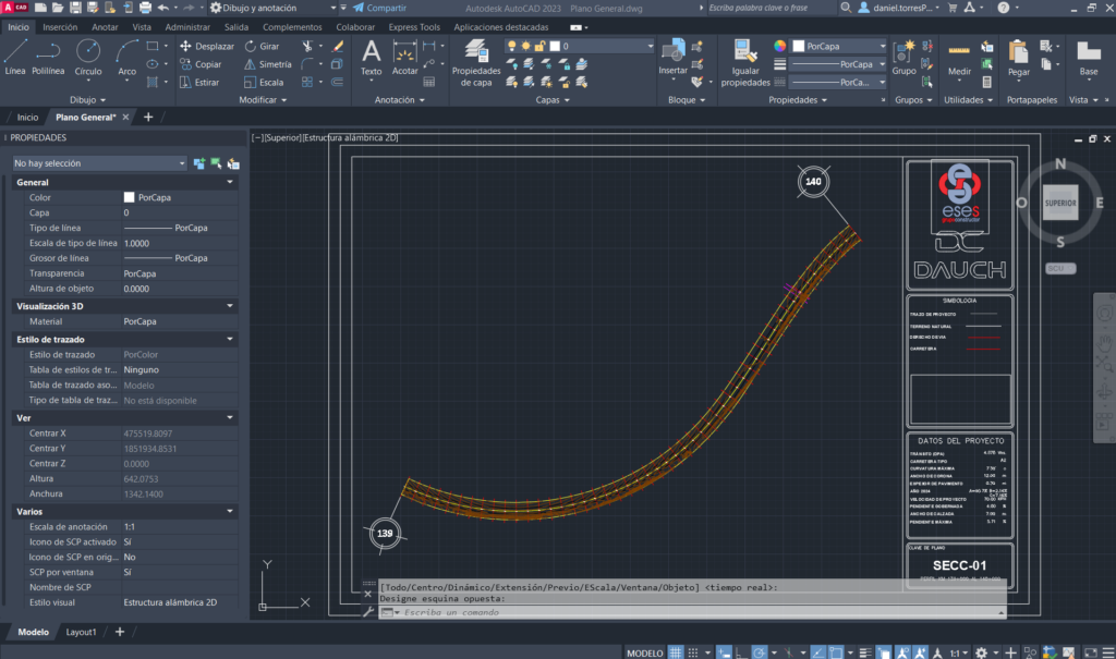
Sections and Profiles

Generating Cross-Sections and Longitudinal Sections

Slopes and Structures

Slope Gradients, Buildings, and Infrastructure

Profiles

Accurate Analysis and Modeling of Linear Infrastructure

Technical Considerations

What LiDAR can demonstrate, and what we should consider

Every site has different conditions. Understanding LiDAR's capabilities and limitations allows us to assess how to conduct the survey and what information we can obtain.

Limitation due to dense vegetation

Very dense vegetation reduces the amount of laser light that reaches the ground.

Weaker signal in water and on dark surfaces

Water and extremely dark areas reflect very little light.

A photo is required to add color

The sensor does not detect color on its own; it is supplemented by cameras.

Results and Deliverables

The data is the beginning; the value lies in what we do with them

PointCloud 1 - Dauch

LAS / LAZ Format

Classified point cloud

Digital Surface Model - Dauch

TIF format

Digital Elevation Model​

Digital Terrain Model - Dauch

TIF format

Digital Elevation Model

Floor Plan 2 - Dauch

DGW / DXF / SHP Format

CAD Floor Plans

Orthomosaic - Dauch

TIF format

Orthomosaic

Screenshot 2026 10 19 130016 - Dauch

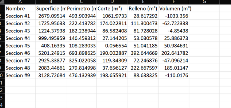
CSV / XLXS Format

Strategic Data and Volume Estimates

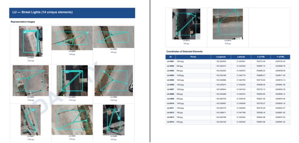
AnalisisIA - Dauch

PDF / CSV / DXF Format

AI Analysis

SOLUTIONS

When your understanding of the terrain changes how you plan your project

LiDAR data can support various stages of a project, from pre-design analysis to as-built documentation and volume estimation.

Land ready for development

Survey of the terrain beneath the vegetation prior to the first survey line.

Roadways without road closures

Lifting from the air, without stopping traffic.

Volumes and Inventories

Cuts, backfills, and stockpiles calculated based on the actual surface area.

Construction Progress with Supporting Evidence

Comparisons by date to measure what was actually built.

Updated Land Registry

Land and buildings surveyed without walking through each lot.

Processing

BEFORETAKING ACTIONYOU MUST
UNDERSTAND THE
SECTION

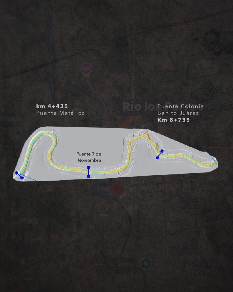
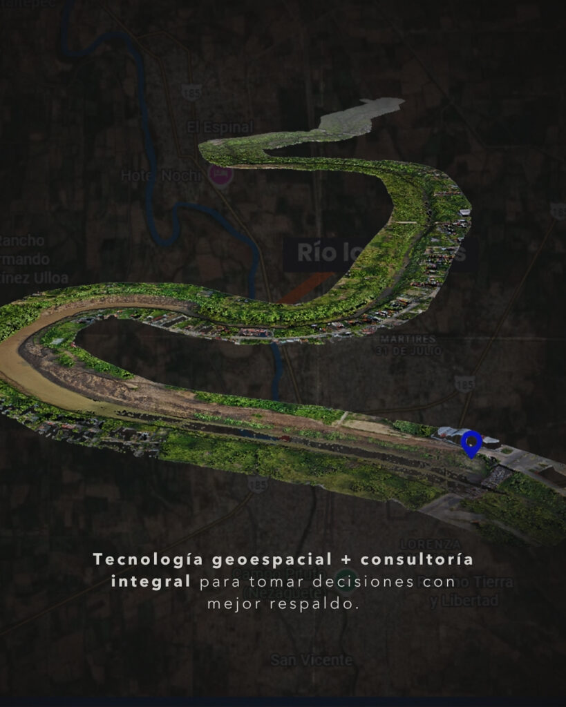
How do you plan the dredging of a 4.2-kilometer stretch of a river?

In Juchitán, Oaxaca, a project of this magnitude required an assessment of the riverbed conditions before any work could be done on it.

Find out how we tackled this challenge and what information we gathered to support the planning of the work.

Click here to learn more
Real-World Case Study · LiDAR and Photogrammetry

Los Perros River, Juchitán: Topographic Information for Planning Dredging Operations

01 · The Challenge

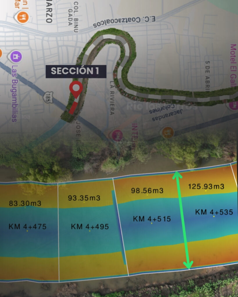
Following the severe floods of October 2024, topographic data on the Los Perros River was needed to assess the condition of the riverbed, evaluate the accumulated sediment, and determine the scope of the dredging work.

02 · How did we do it?

We conducted a survey using LiDAR and photogrammetry in August 2025, generating point clouds and three-dimensional models with a reported accuracy of 3 cm.

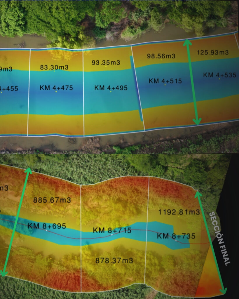
Using this data, we analyze cross-sections of the river to assess the river channel and estimate the volume of accumulated material.

03 · What did we get?
  • 55.68 collectedand analyzed
  • Cross-sections every 20m to assess the river channel
  • 187,645.60 m³ ofmaterial estimated for removal

The value of the results: a technical basis for determining the scope of the work, estimating the volumes to be removed, and supporting the planning of an intervention aimed at reducing the risk of flooding.

We'll help you determine whether this is the right technology for your project

Does your property have vegetation or complex slopes?