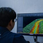
Survey Using a Drone

Drone Surveying: Guide, Applications, and Benefits

Essential Guide to Aerial Surveying

Imagine getting a 3D map of your property in a matter of hours, without having to walk every centimeter of the job site. With drone surveying, you can make your surveying projects faster, safer, and more accurate. 

Thanks to state-of-the-art LiDAR sensors and photogrammetry, you get georeferenced point clouds, orthomosaics, and digital elevation models that are ready for analysis and design. In this guide, we’ll explore how the technology works, what deliverables you can expect, and why more and more engineers, agronomists, and urban planners are relying on drones for their topographic surveys.

Drone Surveying Services - Multispectral​

What are drone surveys?

Drone surveys use unmanned aerial vehicles equipped with optical and LiDAR sensors to capture geometric and thermal data from an area. Unlike traditional methods, this technique:

  • Reduces field time by up to 5 times
  • Penetrates dense vegetation thanks to LiDAR
  • Generates GIS- and CAD-ready data

Cutting-edge technologies

Technology

Primary Function

Applications

LiDAR

It emits laser pulses and measures the return time to generate high-precision point clouds

Detection under vegetation, volumetric measurements

Photogrammetry  

Captures georeferenced images and calculates dimensions and shapes

Planimetry, orthomosaics, crop mapping

GPR

Ground-penetrating radar for subsurface exploration

Detection of pipes, foundations, and cavities

Deliverables and Practical Applications

  • High-precision point cloud
  • Contour lines and terrain profiles
  • Digital Surface and Elevation Models
  • RGB Orthomosaics
  • Multispectral Maps for Precision Agriculture
  • Sections and Profiles for Civil Engineering Projects
Shop Items 2

Key Benefits

  • Millimeter-level precision across large areas
  • Greater safety: You minimize manual fieldwork
  • Speed: You speed up decision-making
  • Versatility: You can adapt the drone for surveying, agriculture, and industrial inspection
Our Projects

Step-by-Step Process

  • Flight planning: defines the area, altitude, and overlap patterns.
  • Data Collection: Drone-mounted LiDAR and multispectral cameras.
  • Processing: generation of point clouds, orthomosaics, and models.
  • Delivery: GIS/CAD packages ready for integration into your project.
Lidar Check

Frequently Asked Questions (FAQ)

Can I get topographic surveys without leaving my office?

Yes. You approve the flight plan and receive the digital deliverables, ready for your review.

LiDAR penetrates dense vegetation and captures only the ground points.

It depends on local regulations. In general, coordination takes place with the aviation authority, and flight authorizations are processed.

Request a quote for drone surveying.